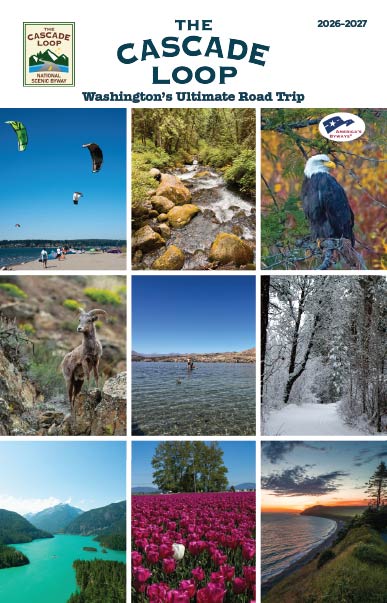
33 Table of Contents The Cascade Loop Travel Guide is produced annually by The Cascade Loop Association, a nonprofit organization. Our mission is to provide a world-class road trip for our visitors while delivering value to our stakeholders. Cascade Loop Association P.O. Box 3245, Wenatchee, WA 98807 (509) 662-3888 info@cascadeloop.com CASCADELOOP.COM ©2023 Cascade Loop Association All Rights Reserved. Executive Director Roni Freund Designer Roni Freund Printing Lynx Group Cover Photo Pete Freund North Cascades Highway near Marblemount Photos in this guide were taken by staff of the Cascade Loop Association, unless otherwise noted. Liberty Bell MountainAndy Porter4 Collect stamps from participating visitor centers and lodging properties and receive collector prizes. When you visit all nine regions, you can enter to win a fabulous prize package from our partners all around the Loop! See the Souvenir Passport on page 78 and find all the locations to collect them and contest details on our website! You can start your adventure anywhere on the Cascade Loop, but we like to present the information in an organized way, so we identify our nine regions beginning in Seattle NorthCountry, at the ferry dock in Mukilteo. The main highway systems flow more than 440-miles from the Salish Sea in Western Washington, over the mountains, across the shrub steppe of Eastern Washington, and through the lush valleys in between. Through river valleys and national forest lands you cross the Cascade Mountain range not once, but twice. The Cascade Loop is a perfect encapsulation of all the best Washington State has to offer – scenic beauty, amazing recreation, and fabulous food and beverages from farms and fields, rivers, and salt water! For those planning to explore the Loop in its entirety, we recommend traveling counterclockwise through the nine distinct regions, to see the most scenic views of our iconic landmarks, including Liberty Bell on Highway 20. Some do it in a long weekend, but our recommendation is to savor the journey and allow a week or more. No need to rush, there’s plenty to see, do, and experience. Bear in mind, at some point after snow begins falling in the mountains, a 44-mile stretch of the North Cascades Highway will close west of Mazama and east of Diablo. The Loop becomes the "Cascade Crescent” and is still worthy of the title "Washington State’s Ultimate Roadtrip!" Where's the best place to start my trip? Passport Prize Package!5 Launch GPS Apps before you hit the road! The majority of the byway has great service but there are spots where you may lose signal and a few regions where service can be spotty. If you use your phone for GPS navigation, map your route before you leave home or your hotel, to ensure the linkup lasts when you get on the road! Where can I fly in and rent a car to access the Loop? Depending on where you’re flying from, we have a few options: Sea-Tac International Airport near Seattle, Pangborn Memorial Airport in Wenatchee, Paine Field Passenger Terminal in Everett and Bellingham International Airport, in Bellingham. Frequently Asked Questions Travel Advisories Get the latest news on conditions that could impact your travel plans on the Cascade Loop: cascadeloop.com/roadway-advisories & wsdot.com/Travel/Real-time/Map fe Elevations around the byway Everett...................................................82 ft. Stevens Pass.....................................4,061 ft. Leavenworth....................................1,171 ft. Winthrop..........................................1,768 ft. WA Pass Overlook............................5,477 ft. Diablo Lake Overlook.......................1,201 ft. Sedro-Woolley.......................................56 ft. Oak Harbor............................................92 ft. fe Know Before You Go! TREAD Map is a smart phone app that connects outdoor enthusiasts through real-time interaction between land managers, user groups, and local businesses. It is free to all users and always will be, thanks to ongoing support from the State of Washington Tourism. It is a community-powered platform to equip users to recreate respectfully, and generates more possibilities for sustainable recreation. Can my RV or travel trailer handle the Cascade Loop? Absolutely! Our scenic byway is comprised of well-maintained roadways courtesy of our friends at WSDOT and we have all manner of RV-equipped campgrounds on and near the byway. fe What’s the best way to travel the Loop? You can travel either direction, but counterclockwise offers the easiest access to our most iconic views! fe6 The Cascade Loop is Scattered throughout our guide you will see "" indicating a pet-friendly activity, park, off-leash location or lodging property. Learn more online: cascadeloop.com/pet-friendly-travel Pet-Friendly Twisp River Suites Looking for a stroller or wheelchair- friendly trail? Watch for the icon indicating a paved or flat gravel trail suitable for all abilities. Learn more online: cascadeloop.com/accessible-trails Stroller and Wheelchair-Friendly Trails Tommy Thompson Parkway, AnacortesMade possible in part with assistance from Snohomish County Tourism Hotel-Motel Tax Fund Mukilteo Ferry Terminal, Pete Freund Mountain Loop Scenic Byway8 Mukilteo •A coastal community on the shore of the Salish Sea and the unofficial start of the Cascade Loop! •Washington State Ferry located near Lighthouse Park, is the gateway to Whidbey Island (Clinton/Mukilteo route) • Tails and Trails Japanese Gulch Dog Park, a ¾-acre, fully fenced, gated off-leash dog area featuring agility equipment. 1301 5th St. Kick off your Cascade Loop adventure in Seattle NorthCountry, which boasts 2,000 square miles of mountains and rivers, cities and towns, farmlands and coastlines in Snohomish County. Look for three distinct environments on this part of the Loop: coastal communities, river valleys, and urban centers. This region enjoys a temperate climate year-round, making it an ideal destination for outdoor adventures in every season. Everett •The largest metropolitan community on the Loop •Vibrant urban center known for international cuisine and a growing waterfront district •Funko! Headquarters facility for these collectibles—awesome spot for selfies and souvenirs. 2802 Wetmore Ave. •Everett Marina, largest public marina on the west coast – perfect for walks on the dock to check out the aquatic life Audubon Washington gives a nod to the Cascade Loop as part of the Great Washington State Birding Trail. This family of great blue herons were spotted along Everett's waterfront. Other parks along the inter-tidal mud flats and shallow bays, along with neighboring Snohomish and Skykomish River Valleys, are great places to find osprey, which arrive in spring to nest on offshore pilings as well as purple martins that nest in boxes on pilings. Bald eagles can be seen all year. Check out our Birding Field Guide at cascadeloop.com! Heron family at Everett Waterfront, Pete FreundNext >